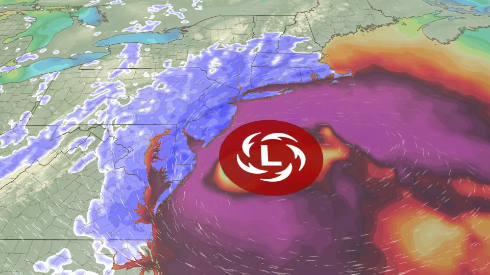
A powerful nor’easter is developing along the eastern coast of the United States and is expected to bring heavy snow and strong winds across the Northeast. Meteorologist Chris Dolce reports that the storm will intensify quickly and may cause widespread disruptions in several major cities.
The system is forecast to impact areas from the Mid-Atlantic to New England, including New York City, Boston, and Philadelphia. Weather models show the storm strengthening into a bomb cyclone as it moves along the Eastern Seaboard, increasing the risk of blizzard conditions.
Blizzard Warnings Issued for Millions
Blizzard warnings have already been issued across parts of New Jersey, coastal regions of New England, and surrounding areas. Officials are closely monitoring the situation as the storm approaches.
The National Oceanic and Atmospheric Administration has indicated that this storm could create dangerous travel conditions and possible closures across affected regions.
Local authorities are preparing snowplows and emergency teams to respond quickly once snowfall begins.
Heavy Snow and Strong Winds Expected
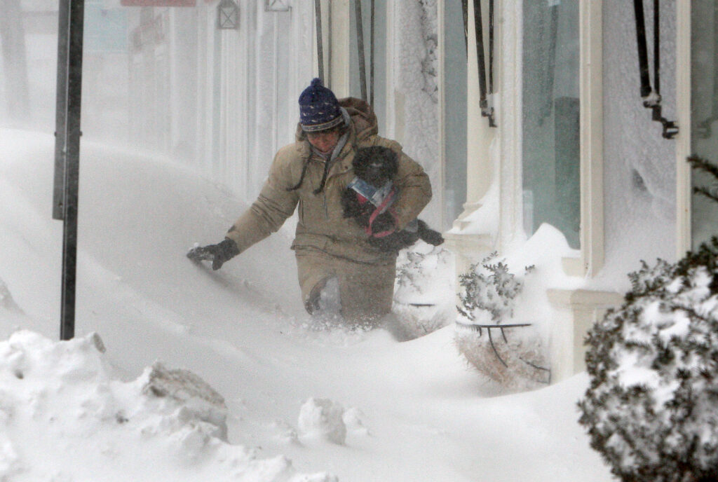
Forecasts suggest that snowfall totals could exceed one foot in some areas, especially near coastal regions. Snowfall rates may become intense during the peak of the storm, reducing visibility and making travel extremely difficult.
Strong winds could gust above 40 mph, increasing the chance of fallen tree branches and scattered power outages. Heavy and wet snow will add extra weight to trees and power lines, raising safety concerns.
Coastal areas such as Long Island may also experience minor coastal flooding due to strong onshore winds.
Below is a comparison of expected weather conditions in key cities:
| City | Expected Snowfall | Wind Risk | Travel Impact |
|---|---|---|---|
| New York City | 10–14 inches | High | Severe delays |
| Boston | 8–12 inches | High | Major disruptions |
| Philadelphia | 8–12 inches | Moderate to High | Dangerous roads |
| Baltimore | 3–6 inches | Moderate | Slippery conditions |
Storm Timing and Travel Impact
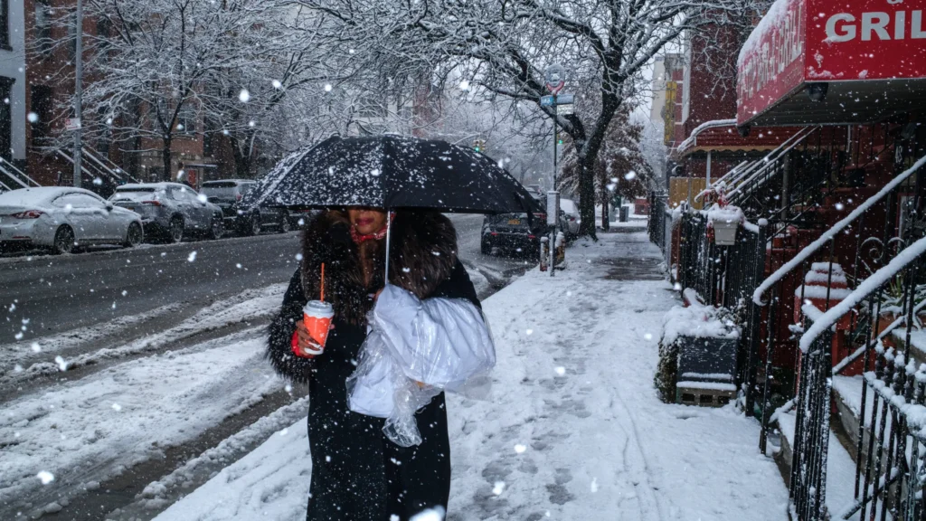
Light precipitation is expected to begin during the day Sunday before becoming heavier by evening. As colder air moves into the region, rain will quickly change to snow across many areas.
The storm’s strongest impact is likely late Sunday night into Monday morning. During this time, snowfall could fall at rates of one inch per hour, and strong winds will further reduce visibility.
Morning commuters on Monday may face major delays or cancellations, especially around airports and highways in large metro areas.
How to Stay Prepared During the Storm
Residents across the Northeast should prepare for possible travel disruptions and power outages. It is recommended to avoid unnecessary travel, charge electronic devices, and keep emergency supplies ready.
For more seasonal updates, readers can check our winter weather section and storm preparedness guides to stay informed as conditions change.